Road, Rail & Barge, Chester


Grid reference: SJ400665
Co-ordinates: 340073, 366560
Bearing: NE
"Steam gives way to sail", they say.
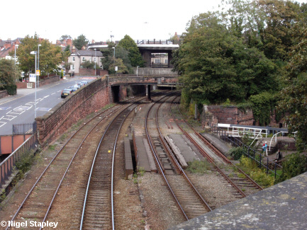
Here, hard by the south-west corner of Chester's City Walls, we can see three stages of transport side by side.
On the left is Raymond Street, with the flyover of the St Martin's Way portion of the 1960s ring-road beyond it.
In the centre is the railway which leads out of Chester, which splits a little way out of the city (behind us here), one branch heading across the North Wales coast to Holyhead, the other southwards to Wrexham, Shrewsbury and Birmingham.
On the right is a lock on the Shropshire Union Canal.
This juxtaposition of routes and modes of transport must be very rare, if not unique.
© Nigel Stapley


