Penygraig Hill & The Rocks


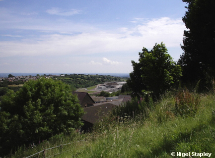

Grid reference: SJ293538
Co-ordinates: 329330,353895
Bearing: SE
This is a view of the former steelworks site from the top of Penygraig hill. You can see the huge landscaping work which has taken place on the old bank during the past few years.
The road down to the small village of Lodge (and on to Wrexham) can now be seen from this point for the first time ever, as the road simply didn't exist before the steelworks bank was thrown up. Even ninety years on, however, it's still known as The New Road.
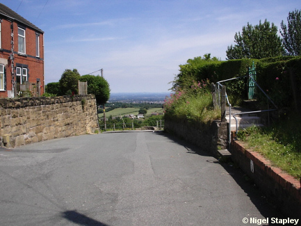

Grid reference: SJ293538
Co-ordinates: 329300, 353887
Bearing: ENE
If I walk out of my front gate, turn right and walk about two hundred metres, I come to this, the point where Penygraig Road emerges at the edge of the slope which leads down to the old part of the village.
Someone in the 1920s had the idea of building a housing estate up here. There was certainly the land, and those 'living on the edge' certainly enjoy superb views, as you can see from some of the other photographs in this gallery.
The house I was born and brought up in was one such, although it was a mixed blessing: during the winter, the prevailing northeasterly winds, coming straight off the Kola Peninsula, caused the insides of the windows to ice over, and rendered my bedroom a particularly inhospitable place for four or five months every year.
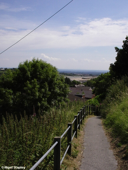

Grid reference: SJ293539
Co-ordinates: 329342,353915
Bearing: SE
Near the top of Penygraig hill, we find the Red Path, a footpath joining the old and new parts of Brymbo.
Why the Red Path? Doesn't look very crimson, does it? Not even russet. Well, originally (and right up to my childhood), the surface was made up of red ashes. A proper bugger that was if you fell over on it; I think it must have been sponsored by Germolene.
The bare plateau of the old steelworks site can again be seen in the middle distance.
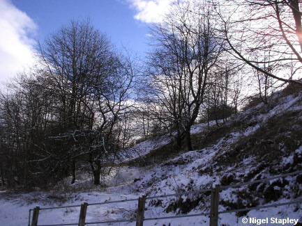

Grid reference: SJ293538
Co-ordinates: 329390, 353830
Bearing: SSW
At the bottom of the Red Path, and separating the Penygraig estate from the older parts of the village is the long, high bank known as The Rocks (or, 'The Rocko', as we called it as kids).
At one time, this was criss-crossed with unofficial footpaths and there were far fewer trees on this, the main slope. As you can see, the trees have now taken over, and the old path tracks have all but gone, too.
The reason for both is that The Rocks are seldom walked nowadays. This is mostly because there is less reason to take this route. My father used to walk up and down here every day on his way to and from work.
The other reason is that children don't seem to play out as much as they used to. We were forever up and down here, walking, playing (plenty of cover for a game of 'Commandos'!), and sliding down on large pieces of cardboard.

Grid reference: SJ293538
Co-ordinates: 329352,353820
Bearing: N
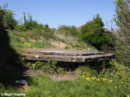
This nondescript concrete platform marks the site of an air-raid observation post from World War II, standing as it does at a point with commanding views over a wide area.
It was called the 'Thrupenny Bit'. Why? Well, it's six-sided, so it reminded everyone of the old three penny (3d) piece.
OK, so the actual '3d bit' was twelve-sided, but folklore is no place for logic.
********
(My niece recently told me that people of her generation (and of her son's) refer to it by a more modern name.
I had confirmation of this when I heard some kids going past while I was gardening. One of them said:
"I'll meet you by the fifty-pence piece!"
The fifty-pence piece is seven-sided, so at least the accuracy is getting better).
© Nigel Stapley


