Blast Road


Grid reference: SJ291536
Co-ordinates: 329190, 353603
Bearing: NW
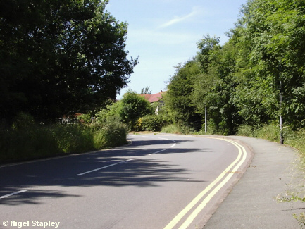
This is the top of Blast Road, which is the main road connecting the old part of the village with the Penygraig estate.
(Why the name? Why, the blast furnace which stood at the bottom end of it, of course!)
The road didn't used to be as wide as this. In fact until the early 1970s, the bank on the right used to come out to roughly where the tips of the shadows on the road are in this photograph. This made for hilarious consequences when any two vehicles met.
There used to be an open drain along the bottom of the bank at this top end, and my first (and only) attempt at riding a bicycle nearly ended in it. It was only that I guessed correctly when trying to decide which lever worked the front brakes and which the back which prevented me from going arse-over-tit into it.


Grid reference: SJ291536
Co-ordinates: 329130, 353668
Bearing: WSW
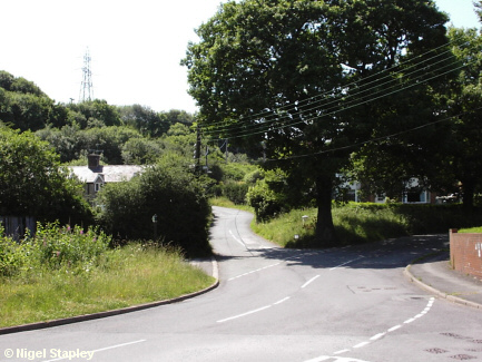
If you didn't know better (and perhaps you don't, but I'm sure it's not for want of trying), you'd think from this that I lived in some sort of rural idyll.
Well, as I said in my introduction, Brymbo sits in a happy location which means that open countryside is never far away. In fact, this scene is scarcely fifty metres from my front gate.
It shows the bottom of Brake Road (centre) and the bottom of Pool Road (centre right), where they meet Penygraig Road (bottom right). Note the large oak tree in the 'V' of the junction, threatening to engulf the power lines.
© Nigel Stapley


