Brymbo East Crossing & Queens Road



Grid reference: SJ298536
Co-ordinates: 329832, 353618
Bearing: N
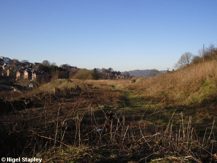
Looking northwards from the former Brymbo East railway crossing on the old Wrexham - Berwig and Wrexham - Mold lines.
(There's a fantastic picture of how the crossing looked in - I'd guess - the early 60s here)
The above shot was taken just after the trees and undergrowth had been cleared for building.
The most recent development (Mount Isa) is centre left in this picture.

Grid reference: SJ298536
Co-ordinates: 329832, 353618
Bearing: N
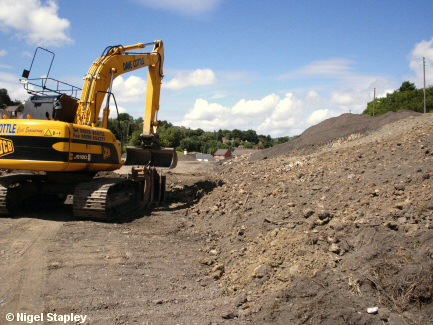
And this is how it looked in June 2008.
The whole of the embankment between the old crossing and where the Tai Bridge once stood was to be removed. Sure enough, they wanted to build houses on it. Nant Court they were going to call it...

Grid reference: SJ298536
Co-ordinates: 329830, 353665
Bearing: SSE
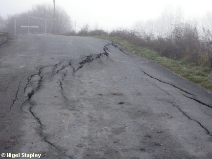
...except this is what happens when you take away thousands of tons of settled rubble, replace it with an equivalent amount of loose topsoil and still expect the road resting on it to stay in place.
At the time of this shot in November 2008, Queens Road had been shut for weeks, with the likelihood of it staying unusable for some time.

Grid reference: SJ298536
Co-ordinates: 329830, 353665
Bearing: SSE
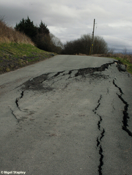
Three months on, and things were getting worse.
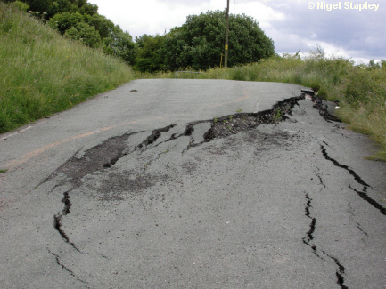

Grid reference: SJ298536
Co-ordinates: 329830, 353665
Bearing: SSE
February 2011, and still going down.
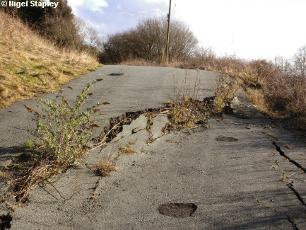

Grid reference: SJ298536
Co-ordinates: 329830, 353665
Bearing: SSE
By June 2009, there seems to be no hope for it.
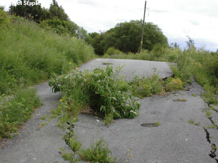

Grid reference: SJ298536
Co-ordinates: 329830, 353665
Bearing: SSE
June 2012, and nature has taken over.
© Nigel Stapley


