Brook Street


Grid reference: SJ333501
Co-ordinates: 333302, 350190
Bearing: SE
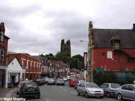
Brook Street forms the southern boundary of Wrexham's town centre.
It is so named from the River Gwenfro which now runs through a culvert
underneath it, but once ran along the southern (right-hand in this shot) side of the street itself.
The tower of St Giles' Church stands in the background.
It was once the main bus terminus in the town, but now houses a
combination of small shops and the proliferating 'clubs' where the
tarts, chavs and blingers of the town go to get bevvied at least twice
a week.


Grid reference: SJ334501
Co-ordinates: 333380, 350170
Bearing: SW
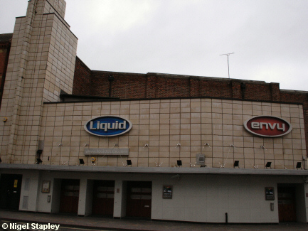
One (or more) of the clubs is/are housed in the old Odeon cinema just
further along on the right.
'Going to the pictures' was always a rare treat in our household
when I was a boy, and it was here that I saw such treats as Bedknobs And Broomsticks
and other exudations of the Disney studio.
For a time, the Odeon was moved right out to the edge of town where you
couldn't get to it easily unless you had a car. It has now moved back into town as part of the Eagles Meadow complex.
© Nigel Stapley


