 This Is Not A
BLOG!
Date: 10/09/09
Leaden-Footed
So, let me tell you about Wednesday.
I hadn't been on a really long walk since September 2006. The weather the last two summers (and the last two Septembers) had been too uncertain (or just plain crap) to be able to plan anything.
I'd had a couple of ideas. One of which was to catch the bus down to Llangollen then walk back home via World's End. However, when I measured the distance on the Ordnance Survey map (by the time-honoured method of putting the straight edge of a piece of paper up against the route and marking the turns on the paper), it came out at slightly over twelve miles. I didn't feel that this was in any way realistic given my condition, so I resolved to pick up where I had left off in June 2007 and complete the top half of the Clywedog Trail.
The forecast for Wednesday was good, so shortly before ten o'clock, I set off.
Map time:
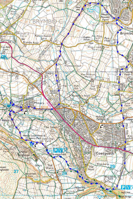
(Start at the top right-hand corner and follow the blue arrows anti-clockwise. As ever, pressing 'Ctrl' and '+' (the one on the number pad) should enlarge the map: 'Ctrl' and '0' will bring it back to the original size)
Passing the eastern side of the electricity substation at Penrhos, I did my good deed for the day in that I rescued a butterfly from a spider's web. OK, it wasn't a good deed as far as the spider was concerned, but there are plenty of them and not enough butterflies.
I turned right at Tŷ Cerrig and up Heol Llewelyn to the top of Fron. The weather was pleasant: not too warm, and not too cool a breeze. I dropped down into the Gwenfro valley, over the bridge and up the mercifully short steep slope on the other side which brought me out at Llidiart Fanny...
Out! Go on! Out! Well, stop sniggering then! It's a real place.
Crossing the Talwrn Road and heading up Heol Offa, I heard a roaring noise from above. Looking skywards, I saw one of the huge Beluga transport planes banking prior to making its final approach to the Airbus factory at Broughton. I've seen these planes a few times, and I'm always amazed at how they manage to stay up there, they appear to move so slowly. On top of which, this one seemed to be so low as to threaten people's TV aerials.
Reaching the far end of Heol Offa, there was then a fun minute or two trying to cross the main road. There was nothing coming down the hill, but the world and his concubine seemed to be coming up.
Anyway, I strode manfully down Rhos Berse Lane towards the real starting point of my walk: Nant Mill. This was where I'd left off last time. I reached there and found a gaggle of people getting out of cars, preparing rucksacks and discussing their route. Although I thought it might be a good idea to set off ahead of them (there were more of them than of me, for one thing), I decided to play it cool and sit by the side of the River Clywedog for a little while:
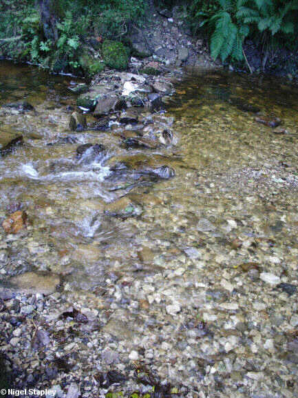
(I took other pictures here, but something weird happened with my camera and the grass on the river bank came out white. I think it's time I got a new camera).
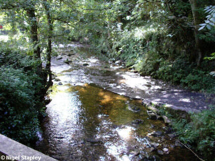
The gaggle was still milling around, mostly popping into the toilets to change into their route-marching gear, so I thought it was time to set off up-river. I crossed the river via the footbridge. I could have been so devil-may-care as to wade through the ford, but I couldn't be sure that my trusty thirty-year-old DMs hadn't sprung a leak so thought better of it. Here's a picture of the ford anyway:
As with the Bersham - Nant Mill stretch I had done in 2007, the woodland north-west of Nant Mill is in the capable hands of The Woodland Trust, and they've done a fine job here, too. The woodland is managed without giving the impression of regimentation, and the paths are well laid down and maintained. At this point, there is a path on both sides of the river, although the path on the northern side crosses over a bridge and joins the southern one within a short distance:
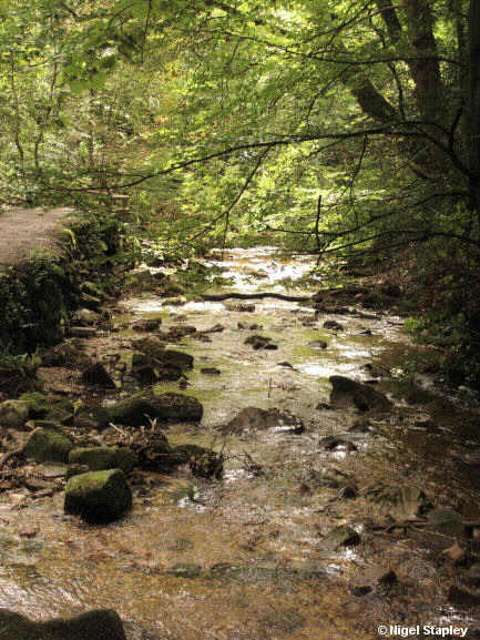
(That water isn't polluted as such, by the way. It's just that there are iron deposits in the rocks it flows through, originally as drainage from the mines upstream.)
The path follows the river closely in this section, passing opposite the remains of a couple of corn mills which probably post-date Nant Mill downstream, and reaches another ford at Stryt Y Sgweiar before veering away to the left and up the slope towards Bramble Farm. It's thought that the line of the path here follows the route of an old tramway which took limestone from the quarries at Minera down to the ironworks at Bersham.
Looking across the valley, you once again get an idea of how big a village Coedpoeth really is. I had passed near its lower end back on Heol Offa, but - a long way further up from my starting point - there was still a fair bit of it to see:
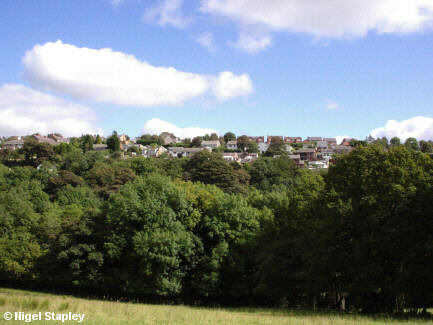
I yomped slowly uphill, stopping to chomp some of the blackberries growing alongside the path, until I emerged into farmland, where cows, sheep and rams grazed in their familiar mindless fashion. The path turns left here and passes a very dingy looking farmhouse before emerging onto the road which runs from Minera to Aberoer and beyond.
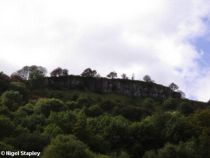
Turning northwards, I was somewhat taken aback to find that I was still three quarters of a mile from Minera. Objects on the map are further than they appear, obviously. I strode onwards (I was still capable of striding at this point) past a small, gated housing development and on to where the side roads for World's End and New Brighton converge, which is where I took the following picture of the Graig Fawr cliffs:
Lunchtime was nigh, but I was a little confused. You'll see from the map that the Minera Lead Mines And Country Park seems to be on the eastern side of the main road. When you get nearer, however, you find that it is actually entirely on the western side. Not that it makes any practical difference in this case, because the Lead Mines centre is usually closed anyway. The 'Country Park' seemed to consist of about half a dozen of those all-in-one bench-and-table arrangements, but needs must. A nod of acknowledgment to the elderly gentleman, the two younger women and the dog seated nearby, and I sat to fish my two Brussels pâté baps out of the depths of my rucksack (said rucksack having been given to me as a birthday present by my brother and sister-in-law last year and only now getting its first use).
The table at which I was sitting bore (on the opposite end to me, I'm glad to say) the engraved legend, "ADAM AND EMMA HAD SEX HERE". My only thought was that Emma should be easy enough to spot - she'll be the one with the permanently pained expression on her face as a result of all the splinters in her arse.
Lunch duly completed, I left the scene of Adam and Emma's tryst and walked past the entrance to the Lead Mines (which was, of course, closed) along the road which leads to Minera. However, because to get to Minera one has to cross the Clywedog again, it's necessary to go down a long gradient to the bridge before climbing up the other side of the valley.
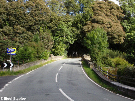
I had wanted to take a picture of the river over the parapet of the bridge, but the view upstream included someone's house, and I'm wary of accusations of invading privacy, and the view downstream was spoiled by the presence of somebody's wheel-trim nestling against the riverbank. So there was nothing for it but to carry on up the other side, but taking notice of this road sign:
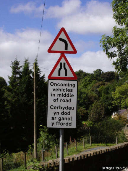
(It happens in most places from what I can see, but it's rare to have an official warning of it).
I had intended to call at Minera Parish Church, but hadn't realised that it is a fair step from the village itself. Nonetheless, I made it (although my feet were starting to give me gyp at this point - the result of not cutting my big toe-nails beforehand). I didn't go inside, although some people seemed to be in there cleaning, and instead wandered around the churchyard for a while. Churchyards are so readable, aren't they? The only trouble for me comes when I find the grave of an infant, especially a recent grave of one. There's one in our local parish churchyard like that, and it's right by one of the paths. I find the whole thing so upsetting that I deliberately choose another exit. The one in Minera is right at the back, but I found it all the same. Suitably unsettled, I made my way out again. I did take some nice pictures of the outside of the church, though. If I can get my hands on some background info about the building, I'll be giving it its own page in the Gallery, so I won't use up space here with them.
I made my way back into Minera village and past the school. Some of the children were outside with a teacher doing some sort of singing game. The tune, however, sounded at first hearing disturbingly like The Ball At Kirriemuir, but I quickly realised that that was just a projection of my filthy mind.
Walking down Minera Hall Road towards the final stretch of the journey, I saw a tree which had unwanted guests:
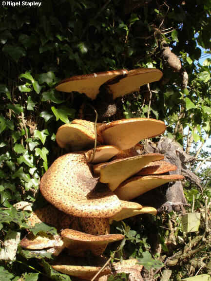
I got back to the main Ruthin Road at Five Crosses and found this piece of very sound advice:
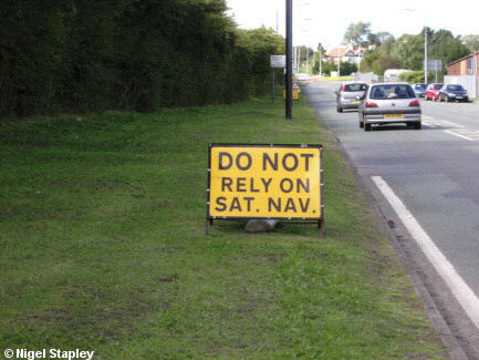
I hobbled off down Gwernygaseg (my toes were in open rebellion by this point) and down to the bottom of Gegin. It was here that I realised - not for the first time - that there was a hell of a climb involved from there to the crossroads at Pentresaeson, I managed it in small doses, climbed over the ridge and back home. I had been gone for nearly six hours.
Of course, since then I have been fit for nothing. It's been a case of, "Ooh, me feet! Me legs! Me hips! Me arse! Me back! Me shoulders!" I had to go into town this morning, and I had some urgent hedge-cutting to do this afternoon, and it has been quite an effort.
Perhaps I'm getting old...


 This Is Not A
BLOG!


