Offa Street


Grid reference: SJ291541
Co-ordinates: 329123, 354137
Bearing: SSE
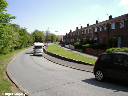
Offa Street was part of the second stage of development at Penygraig, and the council houses are a series of terraces on the western side of the road, which had previously been part of Brynyffynnon Farm. Brynyffynnon House is tucked away behind the trees on the left, and further along is the small Brynyffynnon estate which was put up in the late 1960s to replace prefabricated houses which had stood for a couple of decades before that (and which can be seen outlined in the bottom left of this picture).


Grid reference: SJ291538
Co-ordinates: 329195, 353897
Bearing: N
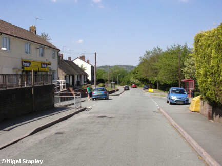
This is Offa Street from the southern end, just before it reaches Penygraig Road. The building on the left is a shop. Way, way back it was two shops, but it combined into one, which was colloquially known as Sooty's because of the collection box in the form of Harry Corbett's little friend which was chained to the front of the shop. It is now the only general store left in the whole village, the other one (known as Bloor's even years after the Bloor family sold it) having closed at the end of the 1990s.
An oddity of Offa Street is its numbering sequence. After the bungalows seen just beyond the shop in this picture, there are no even-numbered houses; they run from '13' to '43'. I suspect that the terraces were put up in the late 1930s with the intention of building more on the other side of the road. The War put a stop to that, of course, and the urgent need for housing afterwards meant that it made more sense to put up the pre-fabs instead. They never bothered to re-number the existing row.


Grid reference: SJ291538
Co-ordinates: 329195, 353897
Bearing: W
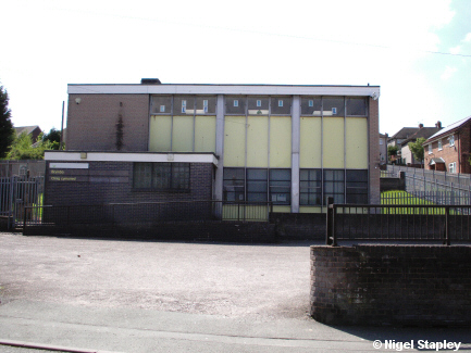
The village was served medically by the same general practice for about sixty years. It was originally the domain of two formidable Irishmen, Dr. Ryan and Dr. McGivern, and operated out of a house in The Lodge. In the late 2010s, the successor partnership was dissolved and GP services were provided by the local Health Trust. It has now been handed over to one of those large concerns which is based on the other side of Wrexham. As a result, virtually no services are provided at this site anymore.
The village library used to be housed in an upper room in the old Secondary Modern school on Ael Y Bryn.
In about 1967, this new building was put up on land previously belonging to Brynyffynnon Farm, and which was, it seems, used to house the chickens.
The clinic occupies the ground floor, with its entrance onto Offa Street, and the Library is on the upper floor, reached by a walkway off the path on the right of this picture which connects Offa Street to Dyke Street.
Or at least the Library used to occupy the upper floor of this building. At the end of March 2014, it was closed by our wonderful Council, controlled as it then was by the arrogant parasites of the Labour Party, supported by enough fake 'independents' who could be bought off to give the thoroughly corrupt time-serving hacks of the 'People's Party' enough of a majority to start abusing local democracy again, as they had done so many times before.
They can find the funding for the office of that completely useless appendage, the Mayor, and to throw money at a carnival of carnage-celebration called 'Armed Forces Day'. But something of benefit to the people of one of the most deprived parts of the county, used by children from the village school every day that it was open? Don't be daft!
Now all we have is a mobile library which calls every two to three weeks. You'd think we were an out-of-the-way hamlet rather than one of the largest villages in the area.
©Nigel Stapley


