Railway Road


Railway Road is a curious creature.
It snakes through the bottom half of the village from the northern end of High Street to the bottom of Station Road, with stretches broad and narrow, and has changed its alignment completely at one point in the last sixty years or so.
Let's start at the further (lower) end and work our way up, shall we (if only because that's the order I took the photos in and I can't be arsed reversing the file-number sequence now)?

Grid reference: SJ298536
Co-ordinates: 329819, 353610
Bearing: NW
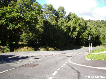
Railway Road enters the village at the top of New Road (B5101) at the south-eastern corner of Brymbo, where it also joins the bottom of Station Road which leads up into Pentre Broughton. Here's a view of the junction looking down Railway Road towards where Tai Bridge (q.v.) formerly stood, and just to the west of where Brymbo station stood.
The low wall still to be seen on the right is the remains of the front-yard wall of Bethel chapel, which stood on this site until the mid-1970s. You can see the chapel and the railway crossing in this superb photograph from the early 1960s.

Grid reference: SJ297536
Co-ordinates: 329788, 353644
Bearing: NW
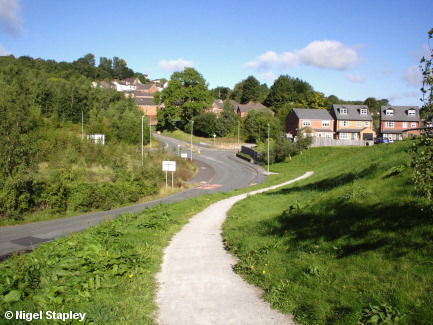
This shot is taken on the footpath which runs below the alignment of the former railway line from Wrexham, and which is part of the Nant Court development which initially caused the collapse of Queens Road over a decade ago. Part of Nant Court can be seen centre right, with Mount Isa towards the upper left.
Most of the road seen on the left is still on the old alignment prior to the laying of the new 'Spine Road' but now, instead of curving round to the right, Railway Road is interrupted by a crossroads (see below).

Grid reference: SJ297536
Co-ordinates: 329707, 353691
Bearing: N
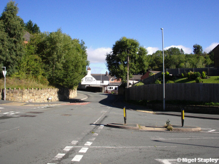
This is where the sharp bend on Railway Road has been replaced by a crossroads. This was the site of the old Tai Bridge (which can be seen in this photo taken sometime in the late 1970s).
As you can see from that photo, the stated headroom for the bridge was 15' at the top of the arch but - as it was an arch - the clearances at the side of the carriageway were much lower and, taken in combination with the narrowness of the road and the fact that it was on a sharp bend, this meant that we could never be served by double-decker buses.
You can also see in that photo that the bridge had something of a kink in it. The reason for this is that it carried two railway lines which went off in different directions once they had crossed the bridge. One line (which was on the side nearer to us) went towards Brymbo Middle crossing and on to Minera and Berwig (or to connect up with the Fron Branch of the line into - and through - the steelworks), whereas the line on the further side of the bridge curved off and headed towards Mold, necessitating a slightly different alignment. More on this a little later.
The original wall at the base of the bridge (which was demolished in the 1990s) can be seen on the right of the junction; the wall on the left-hand side of the road is recent. The Tai pub stands beyond the bend.

Grid reference: SJ297537
Co-ordinates: 329702, 353732
Bearing: N
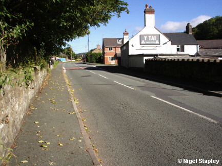
The Tai pub. That was its original name, but it was changed to the Black Lion by its then-owners Burtonwood Brewery sometime in the mid-20th century. Latterly, however, the 'official' name reverted to what everybody had carried on calling it all along anyway. Beyond that is the entrance to Fairfield, a small estate built some twenty-odd years ago on the site of the field where the annual village carnival used to be held (hence the name; some things in the modern world still obey basic logic).

Grid reference: SJ297537
Co-ordinates: 329717, 353755
Bearing: S
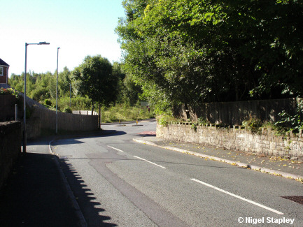
Looking along the outside of The Tai back towards the old bridge site. The wall on the right is original.

Grid reference: SJ297537
Co-ordinates: 329707, 353779
Bearing: NNW
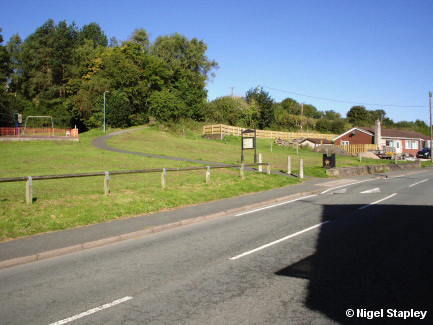
Looking across from the entrance to Fairfield at what is now a play area. However, the footpath marks the former alignment of Railway Road, which used to run round the back of a terrace of houses which once stood where that litter bin is now. The front garden wall of the terrace is still in situ between the bottom of the footpath and the bungalow beyond.
More on the change of alignment later.

Grid reference: SJ297537
Co-ordinates: 329707, 353797
Bearing: SSE
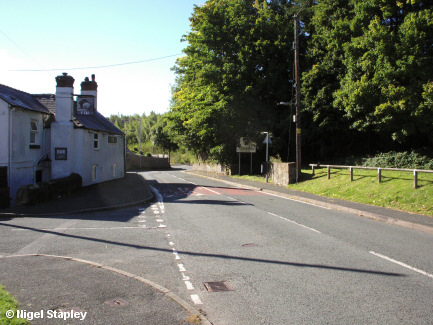
Another look back past The Tai towards the old bridge, this time taken from the entrance to Fairfield.

Grid reference: SJ296538
Co-ordinates: 329684, 353838
Bearing: N
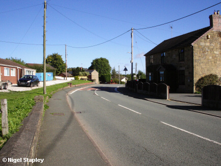
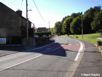
Moving north now, and here's Railway Road as it approaches the Cross marking the junction with Coedyfelin Road, Green Road and Queens Road. The front garden wall of the cottages stands at front left.
The house on the right - called Colenso - was once a shop and apparently a billiards hall before that. Out of shot to the right is one of the two former police houses in the village. Nowadays, the nearest cop shop is two miles away in Coedpoeth, staffed by the law-enforcement equivalent of team vicars.

Grid reference: SJ296538
Co-ordinates: 329689, 353881
Bearing: SSE
Another look back towards the Tai. On the left is the forecourt of Queens Cross Garage, which was once also a petrol station (even fairly small villages had one of those at one time). Prior to that, it had been the site of a cinema, something else that villages had in those days.

Grid reference: SJ297539
Co-ordinates: 329721, 353922
Bearing: WSW
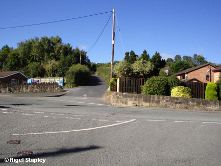
Here's the junction at the Cross, which marks the current alignment of Railway Road (the road leading off opposite). This road did previously exist, but as little more than a shortcut down the hill rather than as part of Railway Road 'proper'. That changed when the old alignment round the back of the cottages was closed some decades ago.
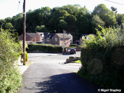
I can't help thinking that it would have been far better to keep the old alignment. As you can guess from this photo, this junction is completely blind from the Coedyfelin Road side (coming in from the right) and near-misses are scarcely unknown here...

Grid reference: SJ296538
Co-ordinates: 329661, 353883
Bearing: NE
...as this photo may make clearer.
The houses across from the junction were built on what used to be Green Bros. haulage yard, which in turn was built on the site of the former Queen's Head pub which was demolished during World War II by an unexploded bomb deciding that it wanted to be an exploded one instead (no fatalities, a few injuries and a fair bit of flying masonry).

Grid reference: SJ296538
Co-ordinates: 329643, 353848
Bearing: SE
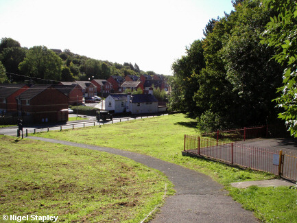
Having got to the top of the 'new' road, let's have a look down the old one back past the play area, with the site of the terrace on the left. This would have been a much easier exit onto the main part of Railway Road even with the houses there.
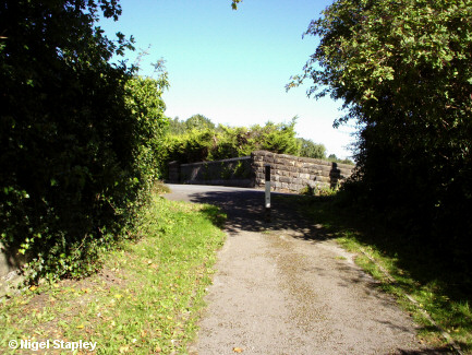

Grid reference: SJ296538
Co-ordinates: 329646, 353849
Bearing: NNW
From the same vantage point, but in the opposite direction, looking back towards the bridge.
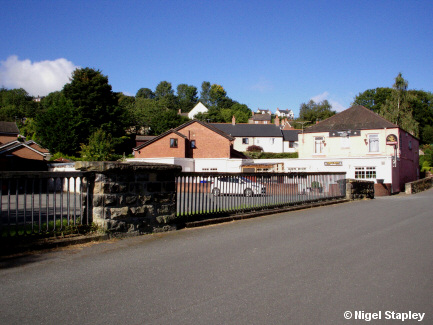

Grid reference: SJ296538
Co-ordinates: 329635, 353880
Bearing: NNW
This bridge, in fact.
Well, there used to be a bridge here. Remember me saying way back up there ↑ ↑ ↑ about the railway line which went to Mold? Well, this used to be the bridge over the stretch which ran between Tai Bridge and Coedyfelin Road before going on over the long-since demolished bridge below the parish church and onwards towards Ffrith.
The underside of the bridge was filled in some thirty years ago (which identical fate befell another bridge on the line as it went under Minera Road some quarter of a mile north of here), but the stonework and the rails remain, as they do on the still-extant bridge over the line at Coedyfelin Road some two-hundred yards or so further along from here.
In the background is the Railway Tavern, one of only four pubs left in the village.
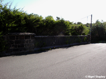

Grid reference: SJ296538
Co-ordinates: 329610, 353878
Bearing: E
This is the other side of the bridge. That leylandii hedge stands at the top of the fill-in, below which stands Coedyfelin Close, which was built in the late 1980s.
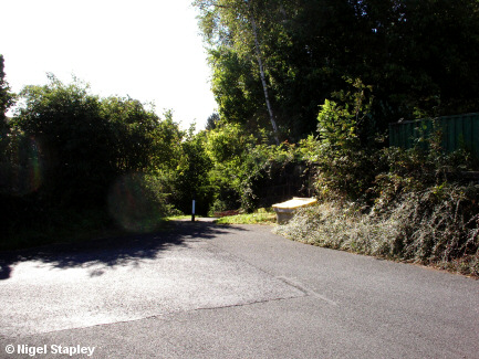

Grid reference: SJ296538
Co-ordinates: 329632, 353884
Bearing: SSE
Another look down the original course of Railway Road.
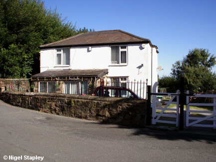

Grid reference: SJ296538
Co-ordinates: 329599, 353895
Bearing: N
This is the Old Parsonage, which stands above the former Mold line and below the Coedpoeth and Minera line. I assume that it was something to do with St John's church which stood further up the hill. A path down the left-hand side of the house leads to Coedyfelin Road, emerging opposite the former Prince Of Wales pub.
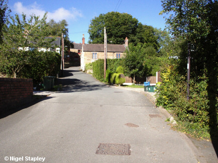

Grid reference: SJ296539
Co-ordinates: 329584, 353908
Bearing: W
At one time, this was the very busy Brymbo Middle railway crossing. The line coming up from Wrexham can be seen on that old photo coming in from the left (and gives you some idea of the gradient involved), and the line straight ahead is the Fron branch through and beyond the steelworks. Behind the photographer, the line goes on via Brymbo West Crossing Halt to Coedpoeth and Minera. Note the sizeable signal box on the right-hand side (seen from the front here).
By the time I remember this crossing, I think the line on the far left had been lifted so that only the centre and right-hand lines remained (I certainly only recall there being two lines crossing the road here) and it seems like the Old Parsonage isn't quite as old as all that, in that the house on the left is clearly not the same one as in my photograph further up this page.
Now two small sets of houses - known as Cambrian Court - have been built along the trackbed either side of the crossing.
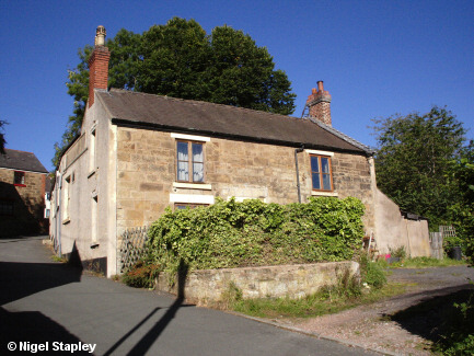

Grid reference: SJ295539
Co-ordinates: 329541, 353909
Bearing: W
The former Furnace Inn on the western side of Middle Crossing. The pub closed sometime in the 1980s and has been a private residence ever since.
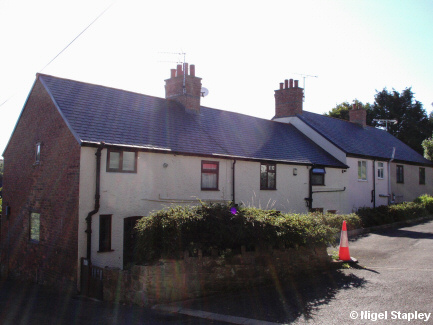

Grid reference: SJ295539
Co-ordinates: 329541, 353909
Bearing: SSW
Turn around 180° and you'll see this row of houses. For many years, Mr Edward Jones (known colloquially as 'Teddy Bandy', and to my father as 'The Flying Evangelist' because he was a Jehovah's Witness and went around on a moped), who took this striking (sorry!) photograph, lived in the house nearest to the camera with his family.

Grid reference: SJ295539
Co-ordinates: 329533, 353922
Bearing: W
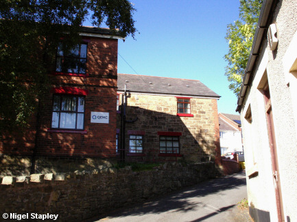
The rear of Cambrian House. According to one source I've consulted, this - or at least, the stone-clad part of it - started off as a shop before being converted into a training centre for the steelworks. Latterly, it has contained a number of small commercial units.

Grid reference: SJ294539
Co-ordinates: 329490, 353950
Bearing: S
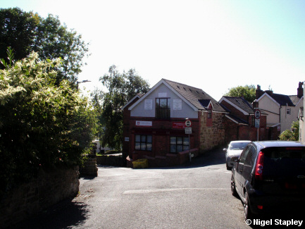
The front of Cambrian House, standing in the angle of Railway Road and Harwd Road. The wall of the Memorial Garden (where St John's church once stood) is on the left.

Grid reference: SJ294539
Co-ordinates: 329490, 353950
Bearing: W
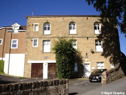
The former Tabernacl Baptist chapel at the junction of Railway Road and High Street. Subsequently extended and converted into flats under the name of Valley View.

Grid reference: SJ294539
Co-ordinates: 329474, 353967
Bearing: WNW
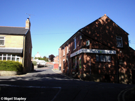
The junction of Railway Road, High Street (off to the left) and Ael Y Bryn (straight ahead). The Well Pharmacy stands on the right of shot, and the building on the left used to be part of the village's Co-op (see this piece for more detail).
(I have to note something amusing at this point - well, I think it's amusing: the company which now owns the pharmacy does have a bilingual signage policy. This means that 'Well Pharmacy' is translated as 'Fferyllfa Well'. The 'joke' is that 'gwell' is the comparative degree of 'da' (which means 'good'), and the mutated form after a feminine singular noun - which 'fferyllfa' is - is 'well'. That means that the name of the place in Cymraeg does in fact mean 'A Better Pharmacy').

Grid reference: SJ294539
Co-ordinates: 329474, 353967
Bearing: SE
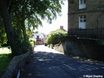
So let us now take one last look back down Railway Road, that long and winding thoroughfare which meanders not only through the bottom half of Brymbo, but through so many facets of the village's history as well. Hope you enjoyed the walk.
© Nigel Stapley


